SailFlowTorontoSt
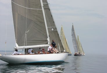
In late June in Toronto, winds are driven less by frontal and large scale storms and more by localized lake breezes. Last year’s Toronto NOOD offered a challenge for many, as winds were light for the first two days then kicked in a bit on the final day.
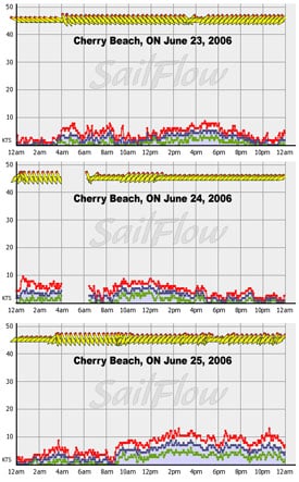
SailFlow| |Graphs show wind velocity from the 2006 Toronto NOOD. The colored lines represent windspeed over time; the yellow arrows represent wind direction over time| The synoptic setup last year saw a large area of high pressure dominating the region, hence the flow was localized for the first two days. The northwest morning land breeze was undercut in the afternoon by a northeast to east-northeast lake breeze. By Day 3 the ridge shifted a bit further north, allowing the prevailing northeast wind to kick in and couple with the afternoon lake breeze to create a stronger, steadier wind.
So far this year, the region has been subject to a blocking pattern with slow moving frontal systems and high pressure dominating. However, long-range models show the potential for a weak area of low pressure to slip through on Saturday, which could mean significantly different winds than last year.
Wind forecasting for Toronto is very challenging because the cold temperature of Lake Ontario tends to create localized effects on the wind, either enhancing and negating the predicted synoptic (large scale) flow. A sailor familiar with the climatology of Western Long Island Sound would have some insight into the climatology of Toronto, as both areas share similarities in their coastal orientation. The wind directions that forecast models most frequently miss are southwest and northeast; be wary of a strong southwest prediction, because these typically warm winds are affected by “doming,” a scenario where the cool, stable air above the lake surface prevents the stronger, overrunning air from penetrating. In contrast, east-northeast and northeast predictions can sometimes be weaker than what actually occurs, since the channeling of winds along the lake axis typically lasts longer than computer models predict.
Knowing what forces are driving winds is of great importance to hold the edge on your competition. Sailflow.com provides real-time sensors as well as forecast products complimentary through the race period at . In cooperation with North Sails, Sailing Weather Service is offering free precision race forecasts for this event. Sign up at http://na.northsails.com/ew/ew_main.taf


