Radar has existed since the beginning of the 20th Century, when countries began experimenting with it as a way of detecting other objects and as an aid to marine and aviation navigation. Radar is a simple concept: The radar emits a pulse and the unit determines the distance of an object by measuring the amount of time it takes for the pulse to travel from the transmitter to an object and back again.
Marine radar is directional, meaning that the unit must spin so as to scan through 360 degrees. This also means that, in addition to simply measuring the distance of an object, marine radar is able to measure the direction of the object. However, caution should be observed: The design of the spinning dome makes the directional measurement (bearing) less accurate than the range measurement (distance).
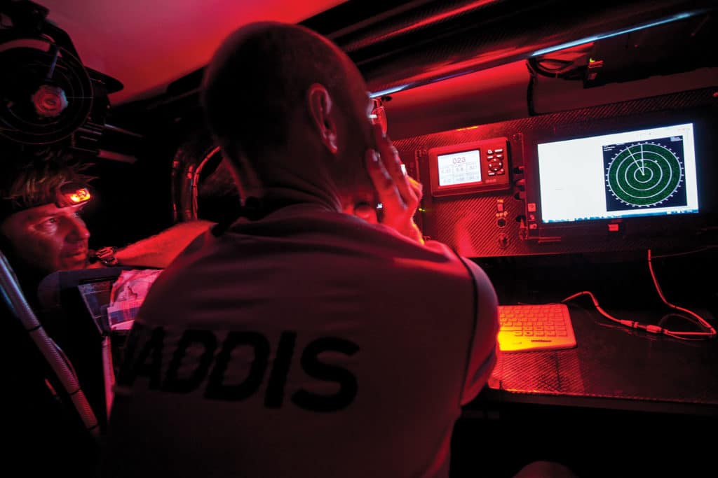
The value of radar as an aid depends on the navigator’s understanding of its characteristics and limitations. Whether you’re trying to determine the range and bearing of a single competitor or trying to detect a coastline in heavy seas, knowledge of its principles and characteristics are key. There are five major functions to consider when interpreting radar images.
Resolution in range is the radar’s ability to separate close targets that are aligned on the same bearing. Traditionally, this was one of the most difficult tasks for radar to achieve. However, with Broadband and HD Radar, much of the skill in interpreting these images is eliminated. One should be mindful when using smaller conventional-pulse radar domes, however, because it’s still possible for groups of boats clustered closely together to appear on the radar screen as a single mass, or for objects close to shore to blend in with the shoreline, creating a false coastline on the radar screen.
Resolution in bearing is the radar’s ability to detect targets that are close together in range, but of slightly different bearings. As with resolution in range, modern technologies have come a long way by improving the separation of targets. An example is the “beam sharpening” feature of broadband radar, which acts like a set of binoculars on the radar beam and allows the user to focus in at a higher resolution on the bearings of interest. For traditional radar, the antenna size directly affects the beam width and hence resolution in bearing. A typical 18-inch dome used on a sailboat is relatively poor at resolving targets in this situation. Broadband technologies are not as affected by this constraint.
Antenna height is a key factor regardless of the radar technology. The higher a radar is mounted, the farther it will see, but this comes with a major compromise, as windage and weight are paramount on a raceboat. The higher the dome is mounted, the more it will be subjected to the effects of pitching and rolling, and the movement of the dome will affect the image you see on the radar screen. I hear sailors complain that their radar cannot see a container ship at 3 miles; they don’t recognize their radar is effectively pointing at the sky because it’s not level with the horizon, and it’s also being affected by pitching and rolling.
Reflection quality and target aspect should always be considered when interpreting your radar screen. Echoes from similar-sized objects can return different signals. For example, a metal object will return a much stronger signal than wood, while certain materials, such as carbon fiber, absorb more radar energy than they return, giving a weak or even non-existent return echo.
Clutter, be it atmospheric noise, sea return, or rain, complicates both radar processing and the image on the radar screen. Clutter is often strongest near your own vessel. It’s usually possible to detect clutter by watching the radar screen for several rotations. Genuine targets will appear at the same ranges and bearings on each sweep, while clutter will change randomly.
One of the greatest challenges for the navigator is determining which features on a shoreline the radar is actually acquiring, and which are clutter. This is most common with low-lying coastlines, where the shoreline may be much closer than the radar depicts. This causes a great deal of uncertainty between the radar and the chart, especially when a radar image is overlaid onto a chart. Sand spits and low beaches often do not appear on ranges greater than 1 to 2 miles because there’s little to return the radar signal. Breaking waves, however, may provide a better return signal. These could be breaking well out from the actual shoreline, which can cause further confusion with the actual position of the shore.
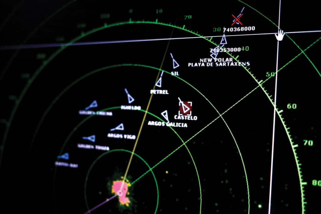
How can we use radar tactically while racing and not just as an aid to navigation in reduced visibility? First, it’s a great tool for tracking competitors, no matter what the conditions. In offshore races I usually do a radar sweep just before dusk to plot the competitors and then try to visually confirm these plots with a hand-bearing compass. This gives me the fleet’s “starting positions” for the evening. During the night I can make periodic sweeps to track the range and bearings of the other boats to keep up to date with which boats are making gains and losses. This can also be a great way of tracking which competitors are sailing in better breeze, provided you have some idea of the performance of the other boats around you.
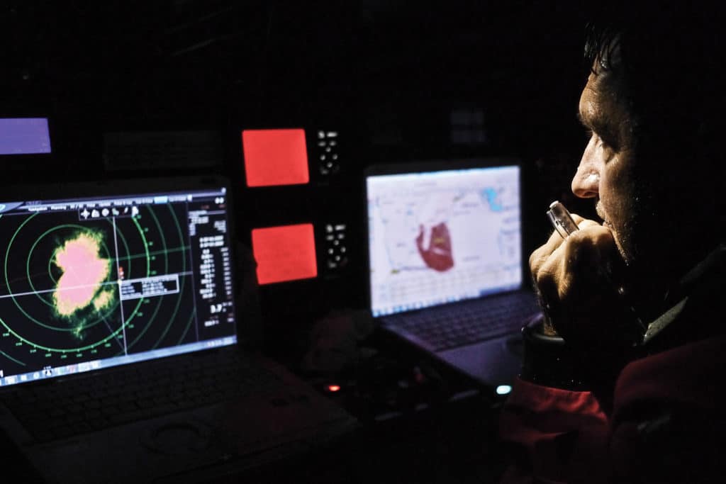
Even more useful than competitor tracking, however, is the ability of the radar to identify rain and, if the radar is correctly tuned, to look through one rain cell and see the next. This allows the navigator to track weather fronts and rain clouds, which is critical tactically, especially in a race such as the Transpac where squalls can have a major effect on the outcome of the race in the latter stages.
Finally, if you have sufficient power to leave the radar scanning, MARPA (Mini Automatic Radar Plotting Aid) tracking allows the navigator to keep track of targets, be they another vessel, competitors, or rain, taking much of the labor out of the tracking of these objects.
The Automatic Identification System (AIS) is a much more recent invention, and it has become extremely popular with sailors. In fact, it’s now mandatory in many of the world’s leading offshore races.
AIS is an automatic tracking system, which shares data with nearby ships, AIS base stations, and satellites (S-AIS). The original intentions of AIS were to assist mariners in collision avoidance and allow maritime authorities to monitor vessel movements. The system makes use of a standard VHF transceiver combined with a GPS antenna (for commercial systems, rate of turn and gyro compass heading are also integrated) and identifies each vessel individually by its Maritime Mobile Service Identity (MMSI). This enables the AIS receiver to calculate navigation information such as Closest Point of Approach (CPA), Time to Closest Point of Approach (TCPA), and collision alarms for each vessel being tracked. The initial requirement for AIS was to provide a text-based list of targets, but today we see more and more AIS being integrated into chartplotter and PC software to give the user a geographical representation on a chart including alternative icons for dangerous vessels, AIS SART, units, etc.
It’s very important to remember that AIS should not be considered as a replacement for radar because not every vessel carries an AIS transponder, and those that have them do not always have the unit turned on.
As with any piece of equipment on board, particular attention should be paid to the installation of the AIS. Because the technology makes use of VHF radio frequencies, it’s subject to the same range limitations as your VHF radio. Installation of the antenna at the top of the mast is ideal to optimize range, as is the use of either a high-quality VHF antenna splitter or an independent antenna for the AIS unit. Another important consideration is the use of high-quality cable and carefully-made cable connections to minimize signal loss through the boat.
Tactically, AIS offers the racing navigator more than radar for competitor tracking, but only if the competitors have AIS and have it switched on. Class B AIS, which is most commonly found on sailing yachts, transmits the vessel’s course over ground, speed over ground, position, true heading, vessel type, and vessel dimensions. Typically this data is sent out every 30 seconds. (Class A AIS units transmit more data every 2 to 10 seconds, but these are most commonly found on commercial ships.) When trying to make use of this data, the racing navigator should remember that the data is sent every 30 seconds and is an instant data capture, not a moving average over 30 seconds, so as with radar, it pays to observe the AIS targets you are tracking and average out their performance over a sensible time period.
Miles Seddon, of the United Kingdom, worked for B&G from 2005 to 2013 before establishing himself as a consultant. While at B&G, he worked with Volvo Ocean Race (developing the electronic package for the VO65), Vendee Globe, and America’s Cup teams. He currently works with Team SCA in the Volvo Ocean Race, managing their performance analysis and instrumentation coaching.